by Ronald H. Chilcote
Adapted from “Nature’s Laguna Wilderness”
Before the Spanish
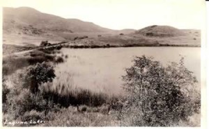
Originally the Laguna Wilderness was home to Native Americans. Remnants of their cultures are scattered in and around Laguna Beach. Two early Native American -cultures are known, the first being the Ute- Aztekas and later the Shoshones, who occupied the canyon lakes known as the Lagonas, apparently a distortion of the Spanish La Canada de Las Lagunas. These names were retained until 1904 when the area became known as Laguna Beach. Most references to Native Americans today in the area are identified with the Acachemem Indians and the Juaneño Band of Mission Indians in the San Juan Capistrano area.
Native Americans undoubtedly lived in caves, but generally they resided in villages of a few dozen to several hundred persons in houses of brush or tules lashed to a frame of poles. Signs of Indian occupation are common as evidenced by soil flecked with charcoal on every ridge that ends at the sea between Corona del Mar and Dana Point. Some sites are believed to have been occupied for thousands of years, although water was scarce, seed-bearing plants were abundant during the summer and fall, and along the coast the rocky shores and bays were full of sea life. Acorns from the oak trees provided another source of nourishment. Their language of Shoshonian origin differed within small areas, for example the Indians south of Aliso Creek had difficulty communicating with those north of the creek.
Spanish and Missions
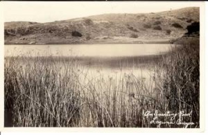
In 1769, the Franciscan priest, Juan Crespi, traveling with Spanish governor Gaspar de Portolá and his soldiers, appeared in Aliso Canyon and described it as: “All the valleys and hills on both sides are of pure earth, well-covered with grass, and without a single stone. So we went on over very open country, with hills and broad mesas, ascending and descending through three or four Little valleys of good soil well-grown with alders” He described the Indians as passive and friendly.
They soon would become dependent on the Franciscan mission established November 1, 1776, as San Juan Capistrano, the first permanent Spanish settlement in Orange County. In the nineteenth century much of the Laguna Wilderness became part of Spanish grants (up to 1822) or Mexican land grants (from 1822 until 1848). To the north of Laguna Beach the 48,803-acre Rancho San Joaquin (later the Irvine Ranch) was carved out by two grants (April 13, 1837, and May 13, 1842) to José Sepúlveda. The first, known as “Swamp of the Frogs” extended from above Newport Bay to Red Hill in Tustin, and the second, called La Bolsa de San Joaquin included what then was Laguna Canyon Creek.
To the south the 13,316-acre Rancho Niguel (later the Rawson then Moulton Ranch) was granted to Juan Avila and his sister Concepción (June 21, 1842) on Land on both sides of Aliso Creek between Laguna Canyon and the mission lands of San Juan Capistrano. José Serrano, who in 1842 was granted lands where present-day Laguna Hills is located and established the Rancho Canada de los Atisos, had been grazing his cattle in Aliso Canyon since 1836.
The land between the San Joaquin and Niguel ranches was settled by Mexicans José Antonio Maria Acuña and Ysidoro Olivares before California was relinquished by Mexico in 1848. Olivares homesteaded 50 acres in what today is Laguna Woods and worked at the nearby Rawson Ranch which later became the Moulton Ranch.
Irvine Ranch
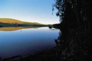
From the 1850s on, cattle roamed the area now known as Laguna Beach, although the drought of 1862-1864 brought devastation. James Irvine, an Irishman who had come to San Francisco in the mid-nineteenth century and made his fortune as a merchant in the California Gold Rush, purchased the Rancho San Joaquin from José Sepúlveda in 1864 and the Rancho Lomas de Santiago from William Wolfskill in 1865. In 1876 he formed the Irvine Ranch. With his death in 1886, the ranch passed to his son, James Irvine II, who assumed control in 1893 at the age of 25. He moved his family from San Francisco after the earthquake in 1906, and decided to shift the land use from ranching to agriculture. This resulted in the replacement of cattle and sheep by oranges and vegetables. The ranch became the world’s largest producer of lima beans, and in 1967 its 971,820 orange trees produced a million boxes of oranges.
With the changing landscape and conditions only remnants of the old ranch exist today. For example, the Bommer Canyon cattle camp remained the site of cattle operations Sunrise Warmth over Alto Laguna on the ranch to the 1970s, and it was the site of a dedication of 2,100 acres of open space by The Irvine Company to the city of Irvine on May 18, 2002. The original ranch home, built in 1876, was destroyed by fire in 1965.
During World War II 4,700 acres of the ranch were sold to the U.S Navy for construction of military facilities, including the air base at El Toro. With the death of James Irvine II, in 1947, The Irvine Ranch fell under the control of the Irvine Foundation. Twenty years later it was sold to outside investors, and in 1983 Donald Bren became the majority stockholder. In 1965, the Irvine campus of the University of California opened, and in 1971 the City of Irvine was formally established and carefully planned as a community.
The rapid growth of Orange County enormously changed the character of the land and the landscape. Even some conservatives, however, objected to the unbridled development that was sweeping the county. Tom Rogers of San Juan Capistrano and others opposed the spiraling growth of the county and provoked wealthy ranchers and homeowners to defend the open spaces and beauty that shaped the places where they lived. They fought corporations like The Irvine Company, Rancho Mission Viejo, and Mission Viejo Company, which sought to reduce open space.
Subsequent installments in future weeks.
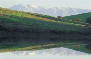
Ronald H. Chilcote has been a long-time board member of the Laguna Greenbelt, Inc. and a founder of the Temple Hills Community Association. His book “Nature’s Laguna Wilderness” was published in 2003 by Laguna Wilderness Press.
Ronald Chilcote photographs “Wilderness: Images and Impressions” are available for viewing through May 11 at Soka University’s Founders Hall Art Gallery. Time: M-F 9 a.m. – 5 p.m. Admission is free.
Photographs courtesy of the author and Laguna Beach Historical Society.




[…] Dilley Preserve was the first parcel of land set aside as permanent wilderness in Laguna […]